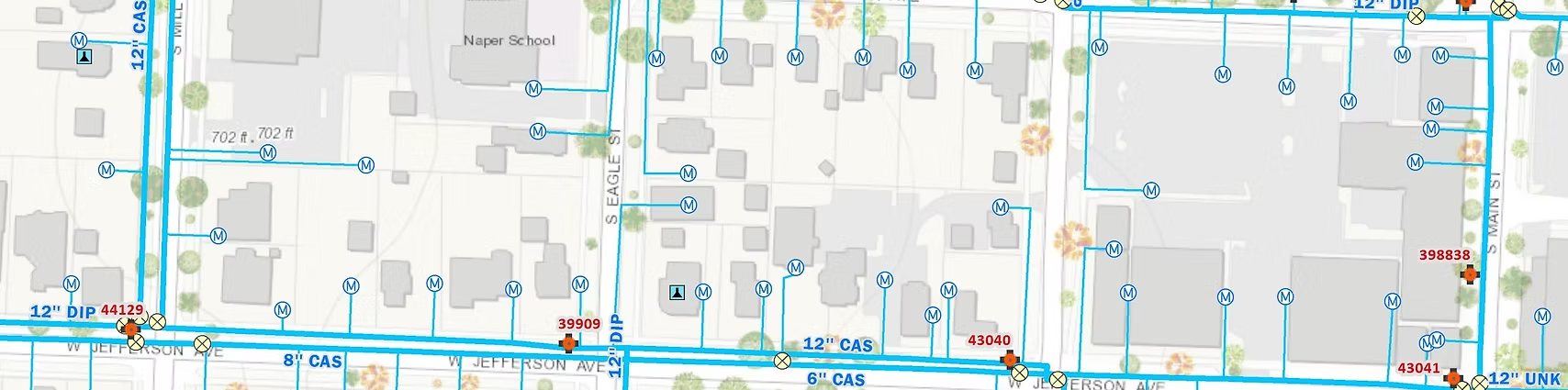


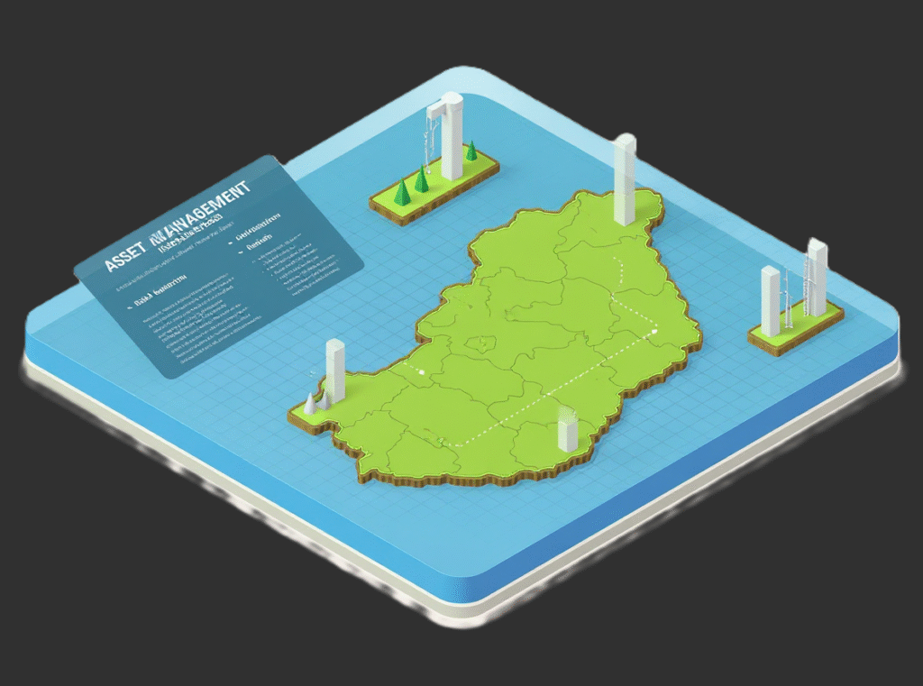
GIS & Asset Management
We specialize in GIS (Geographic Information System) mapping that allows for the integration of multiple geographical data layers. Our GIS solutions provide a comprehensive geo-database of your assets, enabling you to visualize, analyze, and manage your data more effectively. By utilizing advanced mapping techniques, we help you gain deeper insights, streamline operations, and reduce costs. Whether you’re looking to optimize asset management or enhance decision-making, our GIS services are designed to improve operational efficiency and drive long-term success.
- GIS Development
- Geo-data into Actionable Items
- Geo Database Processing
- Spatial Data Infrastructure
We do things differently
At AZ NavTeq, we approach GIS & Asset Management differently — by integrating powerful geospatial intelligence with real-world practicality. Our team combines high-accuracy data collection, interactive mapping, and custom GIS solutions to give you complete visibility over your assets. Instead of static maps, we deliver dynamic, data-driven platforms that help organizations make faster, smarter decisions. From infrastructure management to urban planning, our solutions are designed to enhance operational efficiency, reduce costs, and enable true location-based insight across your projects.
- Comprehensive Data Integration
- Interactive Mapping Solutions
- Accurate Asset Tracking
- Custom GIS Applications
- Advanced Spatial Analytics
- Secure Cloud-Based Systems
Frequently Asked Questions
GIS & Asset Management combines geographic information systems (GIS) with asset data to visualize, track, and manage physical assets efficiently â helping businesses improve planning, reduce downtime, and make data-driven decisions.
Our solutions serve a wide range of industries, including urban planning, utilities, transportation, real estate, oil & gas, and infrastructure management, offering clear visibility of assets across large geographic areas.
Absolutely. AZNavTeq designs custom GIS platforms and dashboards tailored to each clientâs data, workflow, and reporting requirements â ensuring seamless integration with existing systems.
Getting started is easy, simply contact our team through the website form or request a free consultation. Weâll assess your requirements and recommend the best GIS solution for your project.